PIX4Dsurvey
Bridge the gap between photogrammetry and CAD
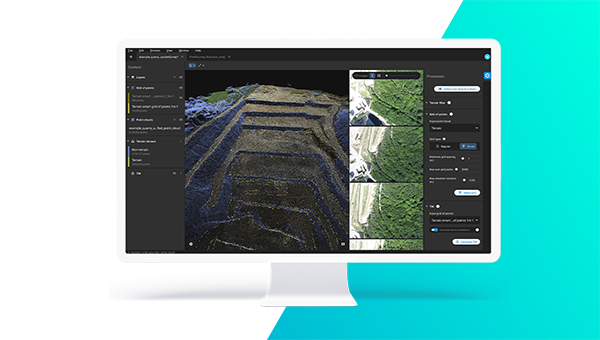
Pix4Dsurvey bridges the gap between photogrammetry and CAD, expanding today’s surveying possibilities. It seamlessly merges photogrammetry point clouds and images, LiDAR, and third-party point clouds into a single project. It offers optimized vectorization and the extraction of essential information such as the bottom and top of curbs and grid of points with just a few clicks. Key outputs: CAD files https://www.pix4d.com/product/pix4dsurvey
PIX4Dsurvey bridges the gap between photogrammetry and CAD. It does so by providing access to the original images and the point cloud through the 3D view to vectorize and extract points, polylines, polygons and catenaries for a shorter time to delivery.
What are the inputs and outputs of PIX4Dsurvey?
PIX4Dsurvey allows the import of PIX4Dmapper and PIX4Dmatic projects, as well as independent .las or .laz files. It is also possible to import .dxf files with 2D and 3D objects. The full list of input files is available in this article.
The main output of PIX4Dsurvey are .dxf and .shp files that can be seamlessly imported in CAD or GIS software.
What is the default coordinate system in PIX4Dsurvey?
While PIX4Dsurvey requires a projected coordinate system, there is no default system. When a PIX4Dmapper project is imported, PIX4Dsurvey will use the coordinate system defined in the PIX4Dmapper project file.
Can I use PIX4Dsurvey with no internet connection?
Not today, but this is planned for future releases.
For now, an internet connection is required for the login, when opening the application and when closing the application. If there is no internet connection at application closing, the license will not be released, and it is not possible to access it from another device.
Features

When using a drone, automate and optimize your flights with the free PIX4Dcapture mobile app.

Work with both imagery data and LiDAR point clouds.
 Generate a TIN to model the ground and create engineering-ready CAD vector files from point cloud data by extracting key elements of your project with PIX4Dsurvey.
 Move from a lightweight point cloud to a model of your terrain. Use the Smart Grid, TIN, and terrain classification to get accurate, actionable results

Beyond the point
Extract only the most relevant information to speed up and simplify your surveying workflows
 PIX4Dsurvey
Bridge the gap between photogrammetry and CAD
Monthly subscription
Billed monthly
Yearly subscription
16% off – billed yearly (USD 1500)
Perpetual


